Strategic Coastal Monitoring Programme
Coastal Partners deliver topographic surveys for the Southeast Strategic Regional Coastal Monitoring Programme and we have been a partner to the programme since 2002. This programme is funded by Defra and is one of six regional programmes included in the National Network of Regional Coastal Monitoring Programmes of England.
Monitoring Surveys
The survey work involves measuring the height and material on the beach and seabed in an organised way to meet the needs of coastal engineering and management. The area of coastline covered by Coastal Partners extends from Havant to Southampton Water, and includes Hayling Island, Portsmouth, Gosport and Fareham coastlines.
Meeting the needs of Beach Management
The programme does this through:
- Understanding the short-term changes and long-term trends of coastal processes;
- Identifying current problems associated with human activities and natural coastal evolution;
- Predicting and monitoring future coastal changes
The data we collect is useful to Local Authorities within the region, Environment Agency, consultants in coastal defence, conservation management and academic research, and for educational purposes. All the data collected is freely available via the Channel Coastal Observatory website.
Topographic Beach Survey
 A beach survey is a form of rapid data collection. This measures the elevation and position of points and presents them as a plot which may include contours, elevations and 3D models. This data can then be used for a variety of uses such as calculating beach volumes and the movement of beach material. At present time, the surveys are generally carried out using Global Positioning Systems (GPS), providing accurate data and the ability to easily revisit a site over time, allowing us to build a picture of how the beach is changing. The data that is collected includes the elevation, co-ordinates, and the type of sediment for each point.
What is a beach profile?
A beach profile is a series of points recorded perpendicular to the shoreline along fixed lines.
These lines, or profiles, can be repeated as often as we require. Profiles are used to build up a picture, allowing us to better understand how the beach responds to storms, sedimentation transport and long-term volume changes across the beach. It also allows us to identify areas that are at an increased flood and erosion risk.

Where do we carry out these surveys?
These surveys are carried out at an average interval of between 200m to 250m around the open coastline. We carry out these surveys from Warsash to Hayling Island. Surveys are not normally carried out within the harbours due to their stable and sheltered nature.
Why do we carry out these surveys?
We carry out these surveys to investigate the effects of seasonal changes around the coast and to gain better understanding and knowledge of the coastline and the natural processes at work. This helps to design better coastal defences that protect against both coastal flooding and erosion. The information from these surveys is also used to help with current beach management so we can determine when and where we need to undertake work. This is done by comparing previous results and interpreting the changes that have taken place.
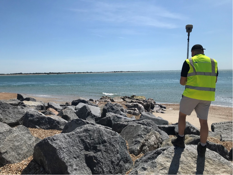
What equipment do we use?
The equipment we generally use is Real-Time Kinematic GPS. This allows us to gather data accurately and efficiently with a vertical accuracy of +/-30 mm and a plan accuracy of +/-15 mm. We use our own base station, located on the roof of Havant Borough Council Plaza building and several mobile receivers or ‘rovers’. The base station transmits corrections via radio signals to the rovers allowing the surveyor to record their position. Data gathering this way allows for speed in data capture which is both accurate and useable.
Waves and Tides
Real-time and historic wave and tide data is extremely important when we try to understand how and why our shoreline changes. It is used to help inform decisions on beach management and the effects that storms have on our coastline.
The Channel Coastal Observatory collect this information through the regional monitoring programme for our frontage.

